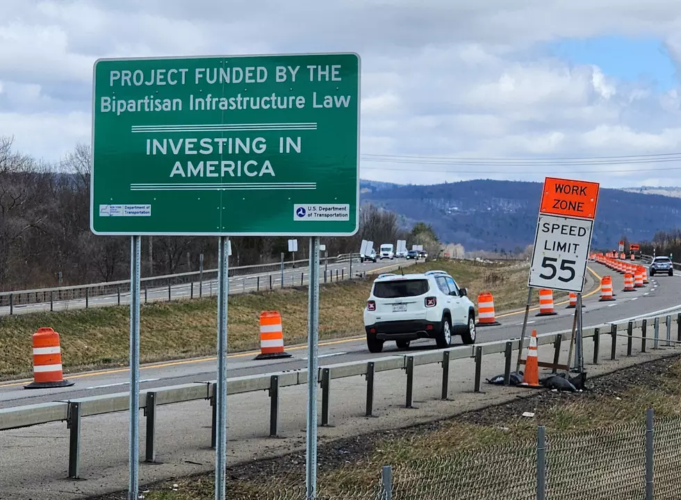
Long-Delayed Route 17 Repaving Between Vestal and Owego Begins
Some relief is eventually coming for drivers traveling on the Southern Tier Expressway through eastern Tioga County.
A two-year resurfacing project on Route 17 in the town of Owego is getting underway this week.
The deteriorating highway surface between Vestal and Owego has been the source of growing frustration for motorists.

Owego town supervisor Donald Castellucci said the work "should have been done years ago." He said he frequently receives complaints from out-of-town drivers who are unhappy about the condition of the highway.
While the first phase of the construction job is underway, Route 17 traffic will be reduced to a single lane in each direction.
For the next several months, all vehicles will use what are normally the eastbound lanes of the highway while resurfacing is being done on the westbound lanes.
Westbound exit 66 which provides access to Apalachin and Campville will be closed for about seven months. Drivers who normally would use that exit will be directed to to the Endicott-Vestal interchange (Exit 67) or the Owego interchange (Exit 65).

Preparation of the work zone started last December with the construction of crossover lanes at both ends of the project area. Emergency pull-offs also have been built for drivers who encounter mechanical problems or other issues.
Normal traffic patterns will return at the end of the construction season. Route 17's eastbound lanes are to be resurfaced next year.
The scheduled resurfacing and rehabilitation of two bridges crossing Apalachin Creek is expected to cost $47 million.

Contact WNBF News reporter Bob Joseph: bob@wnbf.com. For breaking news and updates on developing stories, follow @BinghamtonNow on Twitter.
LOOK: These are the highways in New York with the most fatalities.
Gallery Credit: Stacker
From coast to coast: The 20 best regional fast-food chains to try
Gallery Credit: Kiersten Hickman
LOOK: See how much gasoline cost the year you started driving
Gallery Credit: Sophia Crisafulli
LOOK: These are the highways in New York with the most fatalities.
Gallery Credit: Stacker
More From WNBF News Radio 1290 AM & 92.1 FM