Hurricane Sandy Coming Ashore
Powerful Hurricane Sandy is coming ashore near Atlantic City, New Jersey as a strong Category 1 storm.
Sandy continues to spread heavy rains and very strong winds all along the Eastern Seaboard. Some areas in the mid-Atlantic region have received up to 10 inches of rain with more on the way.
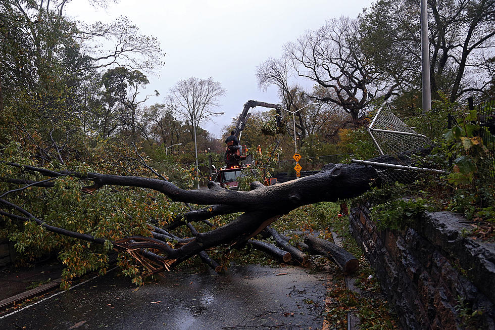
In New York City, strong wind gusts toppled a crane that was perched atop a skyscraper. There are no reports of any injuries but the crane is perilously handing over the side of the building.
Conditions are expected to continue to worsen over the next several hours and coastal areas will see a strong storm surge as the tide comes in.
For the Southern Tier, the winds will begin to reach tropical storm strength this evening and overnight. Gusts could reach 50 miles per hour in some spots. Downed trees and power lines will be an issue of great concern in our area.
As for rainfall, it looks as though the heaviest rain will stay to our south. However, we cannot rule out receiving 3+ inches of rain by tomorrow evening. Flash flooding could occur but river flooding is not being forecast at this time.
Broome, Tioga, and Chenango Counties are under States of Emergencies and that means that no one should be out on the roadways until the order has been rescinded. Only emergency and essential service workers can legally be on the roadways.
Check back to WNBF.com for more updates this evening.
More From WNBF News Radio 1290 AM & 92.1 FM